Google Earth Engine——加拿大数字高程模型(CDEM)是加拿大自然资源部(NRCan)测高系统的一部分,源于现有的加拿大数字高程数据(CDED)

Google Earth Engine——加拿大数字高程模型(CDEM)是加拿大自然资源部(NRCan)测高系统的一部分,源于现有的加拿大数字高程数据(CDED)

此星光明
发布于 2024-02-02 12:00:27
发布于 2024-02-02 12:00:27
The Canadian Digital Elevation Model (CDEM) is part of Natural Resources Canada's (NRCan) altimetry system and stems from the existing Canadian Digital Elevation Data (CDED). In these data, elevations can be either ground or reflective surface elevations.
The CDEM is comprised of multiple DEMs with varying resolutions. These vary according to latitude and have a base resolution of 0.75 arc-seconds. For more information see the Product Specifications
Contains information licensed under the Open Government Licence – Canada.
加拿大数字高程模型(CDEM)是加拿大自然资源部(NRCan)测高系统的一部分,源于现有的加拿大数字高程数据(CDED)。在这些数据中,高程可以是地面高程,也可以是反射面高程。
CDEM是由多个分辨率不同的DEM组成的。这些数据因纬度而异,基本分辨率为0.75角秒。更多信息见产品规格
包含根据开放政府许可证-加拿大授权的信息。
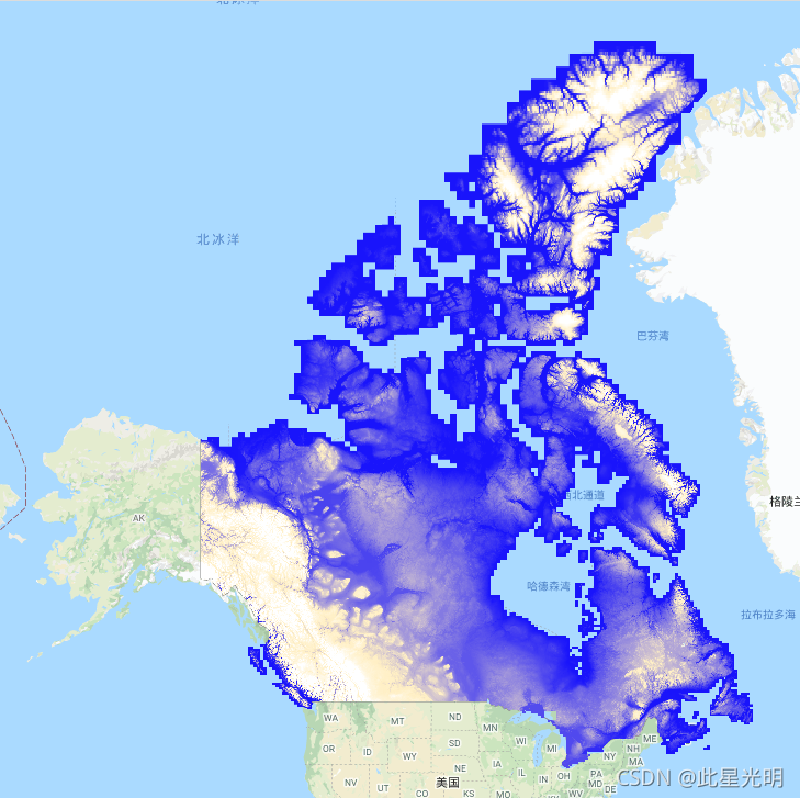
Dataset Availability
1945-01-01T00:00:00 - 2011-01-01T00:00:00
Dataset Provider
Collection Snippet
ee.ImageCollection("NRCan/CDEM")
Resolution
23.19 meters
Bands Table
Name | Description | Min* | Max* | Units |
|---|---|---|---|---|
elevation | Elevation | -226 | 5944 | Meters |
* = Values are estimated
代码:
var dataset = ee.ImageCollection('NRCan/CDEM');
var elevation = dataset.select('elevation');
var elevationVis = {
  min: -50.0,
  max: 1500.0,
  palette: ['0905ff', 'ffefc4', 'ffffff'],
};
Map.setCenter(-139.3643, 63.3213, 9);
Map.addLayer(elevation, elevationVis, 'Elevation');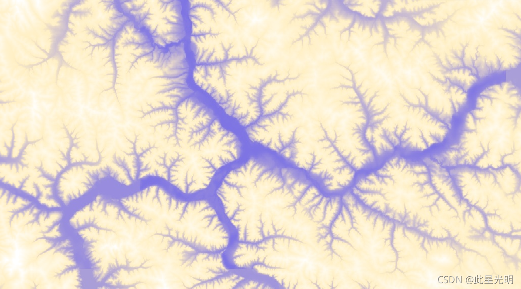
本文参与 腾讯云自媒体同步曝光计划,分享自作者个人站点/博客。
原始发表:2024-02-01,如有侵权请联系 cloudcommunity@tencent.com 删除
评论
登录后参与评论
推荐阅读
腾讯云开发者

Copyright © 2013 - 2026 Tencent Cloud. All Rights Reserved. 腾讯云 版权所有
深圳市腾讯计算机系统有限公司 ICP备案/许可证号:粤B2-20090059 ![]() 粤公网安备44030502008569号
粤公网安备44030502008569号
腾讯云计算(北京)有限责任公司 京ICP证150476号 | 京ICP备11018762号