GoogleEarthEnging—可见光红外成像辐射套件(VIIRS)每日表面反射率(VNP09GA)产品提供了来自Suomi国家极地轨道合作伙伴(S-NPP)VIIRS传感器的土地表面反射率估计。

GoogleEarthEnging—可见光红外成像辐射套件(VIIRS)每日表面反射率(VNP09GA)产品提供了来自Suomi国家极地轨道合作伙伴(S-NPP)VIIRS传感器的土地表面反射率估计。

此星光明
发布于 2024-05-24 08:59:58
发布于 2024-05-24 08:59:58
The Visible Infrared Imaging Radiometer Suite (VIIRS) daily surface reflectance (VNP09GA) product provides an estimate of land surface reflectance from the Suomi National Polar-Orbiting Partnership (S-NPP) VIIRS sensor. Data are provided for three imagery bands (I1, I2, I3) at nominal 500 meter resolution (463 meter) and nine moderate-resolution bands (M1, M2, M3, M4, M5, M7, M8, M10, M11) at nominal 1 kilometer (926 meter) resolution. The 500 meter and 1 kilometer datasets are derived through resampling the native 375 meter and 750 meter VIIRS resolutions, respectively, in the L2 input product. These bands are corrected for atmospheric conditions to provide an estimate of the surface spectral reflectance as it would be measured at ground level.
The data is temporally aggregated over each of the 16 possible passes per day. When multiple observations are present for each day, only the first of the highest-quality observations is included.
For additional information, visit the VIIRS Land Product Quality Assessment website and see the User Guide.
Documentation:
- [User's Guide] (https://lpdaac.usgs.gov/documents/124/VNP09_User_Guide_V1.6.pdf)
- [Algorithm Theoretical Basis Document (ATBD)] (https://lpdaac.usgs.gov/documents/122/VNP09_ATBD.pdf) 可见光红外成像辐射套件(VIIRS)每日表面反射率(VNP09GA)产品提供了来自Suomi国家极地轨道合作伙伴(S-NPP)VIIRS传感器的土地表面反射率估计。提供了三个图像波段(I1、I2、I3)的标称500米分辨率(463米)和九个中等分辨率波段(M1、M2、M3、M4、M5、M7、M8、M10、M11)的数据,标称1公里(926米)分辨率。500米和1公里的数据集是通过对L2输入产品中375米和750米的VIIRS原始分辨率重新取样得出的。这些波段根据大气条件进行了校正,以提供在地面测量的表面光谱反射率的估计。 数据在时间上被汇总到每天16个可能的通道中的每一个。当每天有多个观测值时,只包括质量最高的第一个观测值。 有关其他信息,请访问VIIRS陆地产品质量评估网站并查看用户指南。 文件。 [用户指南] (https://lpdaac.usgs.gov/documents/124/VNP09_User_Guide_V1.6.pdf) [算法理论基础文件(ATBD)] (https://lpdaac.usgs.gov/documents/122/VNP09_ATBD.pdf)
Dataset Availability
2012-01-19T00:00:00 - 2021-09-29T00:00:00
Dataset Provider
NASA LP DAAC at the USGS EROS Center
Collection Snippet
ee.ImageCollection("NOAA/VIIRS/001/VNP09GA")
Bands Table
Name | Description | Min | Max | Resolution | Units | Wavelength | Scale |
|---|---|---|---|---|---|---|---|
M1 | 1km surface reflectance band M1 | -100 | 16000 | 1000 meters | 0.402 - 0.422μm | 0.0001 | |
M2 | 1km surface reflectance Band M2 | -100 | 16000 | 1000 meters | 0.436 - 0.454μm | 0.0001 | |
M3 | 1km surface reflectance band M3 | -100 | 16000 | 1000 meters | 0.478 - 0.488μm | 0.0001 | |
M4 | 1km surface reflectance band M4 | -100 | 16000 | 1000 meters | 0.545 - 0.565μm | 0.0001 | |
M5 | 1km surface reflectance band M5 | -100 | 16000 | 1000 meters | 0.662 - 0.682μm | 0.0001 | |
M7 | 1km surface reflectance band M7 | -100 | 16000 | 1000 meters | 0.846 - 0.885μm | 0.0001 | |
M8 | 1km surface reflectance band M8 | -100 | 16000 | 1000 meters | 1.230 - 1.250μm | 0.0001 | |
M10 | 1km surface reflectance band M10 | -100 | 16000 | 1000 meters | 1.580 - 1.640μm | 0.0001 | |
M11 | 1km surface reflectance band M11 | -100 | 16000 | 1000 meters | 2.230 - 2.280μm | 0.0001 | |
I1 | 500m surface reflectance band I1 | -100 | 16000 | 500 meters | 0.600 - 0.680μm | 0.0001 | |
I2 | 500m surface reflectance band I2 | -100 | 16000 | 500 meters | 0.850 - 0.880μm | 0.0001 | |
I3 | 500m surface reflectance band I3 | -100 | 16000 | 500 meters | 1.580 - 1.640μm | 0.0001 | |
SensorAzimuth | Sensor azimuth angle | -18000 | 18000 | 1000 meters | Degrees | 0.01 | |
SensorZenith | Sensor zenith angle | 0 | 18000 | 1000 meters | Degrees | 0.01 | |
SolarAzimuth | Solar azimuth angle | -18000 | 18000 | 1000 meters | Degrees | 0.01 | |
SolarZenith | Solar zenith angle | 0 | 18000 | 1000 meters | Degrees | 0.01 | |
iobs_res | Observation number | 0 | 254 | 500 meters | 0 | ||
num_observations_1km | Number of observations 1km | 0 | 127 | 1000 meters | 0 | ||
num_observations_500m | Number of observations 500m | 0 | 127 | 500 meters | 0 | ||
obscov_1km | Observations coverage 1km | 0 | 100 | 1000 meters | % | 0 | |
obscov_500m | Observations coverage 500km | 0 | 100 | 500 meters | % | 0 | |
orbit_pnt | Orbit pointer | 0 | 15 | 1000 meters | 0 | ||
QF1 | Quality flags 1 | 1000 meters | 0 | ||||
QF1 Bitmask | Bits 0-1: Cloud mask quality 0: Poor1: Low2: Medium3: HighBits 2-3: Cloud detection & confidence 0: Confident clear1: Probably clear2: Probably cloudy3: Confident cloudyBit 4: Day/night 0: Day1: NightBit 5: Low sun mask 0: High1: LowBits 6-7: Sun glint 0: None1: Geometry based2: Wind speed based3: Geometry and wind speed based | ||||||
QF2 | Quality flags 2 | 1000 meters | 0 | ||||
QF2 Bitmask | Bits 0-2: Land/water background 0: Land & desert1: Land no desert2: Inland water3: Sea water4: ---5: CoastalBit 3: Shadow mask 0: No cloud shadow1: ShadowBit 4: Heavy aerosol mask 0: No heavy aerosol1: Heavy aerosolBit 5: Snow/ice 0: No snow/ice1: Snow or iceBit 6: Thin cirrus reflective 0: No cloud1: CloudBit 7: This cirrus emissive 0: No cloud1: Cloud | ||||||
QF3 | Quality flags 3 | 1000 meters | 0 | ||||
QF3 Bitmask | Bit 0: Bad M1 SDR data 0: No1: YesBit 1: Bad M2 SDR data 0: No1: YesBit 2: Bad M3 SDR data 0: No1: YesBit 3: Bad M4 SDR data 0: No1: YesBit 4: Bad M5 SDR data 0: No1: YesBit 5: Bad M7 SDR data 0: No1: YesBit 6: Bad M8 SDR data 0: No1: YesBit 7: Bad M10 SDR data 0: No1: Yes | ||||||
QF4 | Quality flags 4 | 1000 meters | 0 | ||||
QF4 Bitmask | Bit 0: Bad M11 SDR data 0: No1: YesBit 1: Bad I1 SDR data 0: No1: YesBit 2: Bad I2 SDR data 0: No1: YesBit 3: Bad I3 SDR data 0: No1: YesBit 4: Overall quality of AOT 0: Good1: BadBit 5: Missing AOT input data 0: No1: YesBit 6: Invalid land AM input data 0: Valid1: Invalid AM input over land or over oceanBit 7: Missing PW input data 0: No1: Yes | ||||||
QF5 | Quality flags 5 | 1000 meters | 0 | ||||
QF5 Bitmask | Bit 0: Missing ozone input data 0: No1: YesBit 1: Missing surface pressure input data 0: No1: YesBit 2: Overall quality M1 surface reflection data 0: Good1: BadBit 3: Overall quality M2 surface reflection data 0: Good1: BadBit 4: Overall quality M3 surface reflection data 0: Good1: BadBit 5: Overall quality M4 surface reflection data 0: Good1: BadBit 6: Overall quality M5 surface reflection data 0: Good1: BadBit 7: Overall quality M7 surface reflection data 0: Good1: Bad | ||||||
QF6 | Quality flags 6 | 1000 meters | 0 | ||||
QF6 Bitmask | Bit 0: Overall quality M8 surface reflection data 0: Good1: BadBit 1: Overall quality M10 surface reflection data 0: Good1: BadBit 2: Overall quality M11 surface reflection data 0: Good1: BadBit 3: Overall quality I1 surface reflection data 0: Good1: BadBit 4: Overall quality I2 surface reflection data 0: Good1: BadBit 5: Overall quality I3 surface reflection data 0: Good1: Bad | ||||||
QF7 | Quality flags 7 | 1000 meters | 0 | ||||
QF7 Bitmask | Bit 0: Snow present 0: No1: YesBit 1: Adjacent to cloud 0: No1: YesBits 2-3: Aerosol quantity 0: Climatology1: Low2: Average3: HighBit 4: Thin cirrus flag 0: No1: Yes | ||||||
- Bits 0-1: Cloud mask quality
- 0: Poor
- 1: Low
- 2: Medium
- 3: High
- Bits 2-3: Cloud detection & confidence
- 0: Confident clear
- 1: Probably clear
- 2: Probably cloudy
- 3: Confident cloudy
- Bit 4: Day/night
- 0: Day
- 1: Night
- Bit 5: Low sun mask
- 0: High
- 1: Low
- Bits 6-7: Sun glint
- 0: None
- 1: Geometry based
- 2: Wind speed based
- 3: Geometry and wind speed based
QF2Quality flags 21000 meters0QF2 Bitmask
- Bits 0-2: Land/water background
- 0: Land & desert
- 1: Land no desert
- 2: Inland water
- 3: Sea water
- 4: ---
- 5: Coastal
- Bit 3: Shadow mask
- 0: No cloud shadow
- 1: Shadow
- Bit 4: Heavy aerosol mask
- 0: No heavy aerosol
- 1: Heavy aerosol
- Bit 5: Snow/ice
- 0: No snow/ice
- 1: Snow or ice
- Bit 6: Thin cirrus reflective
- 0: No cloud
- 1: Cloud
- Bit 7: This cirrus emissive
- 0: No cloud
- 1: Cloud
QF3Quality flags 31000 meters0QF3 Bitmask
- Bit 0: Bad M1 SDR data
- 0: No
- 1: Yes
- Bit 1: Bad M2 SDR data
- 0: No
- 1: Yes
- Bit 2: Bad M3 SDR data
- 0: No
- 1: Yes
- Bit 3: Bad M4 SDR data
- 0: No
- 1: Yes
- Bit 4: Bad M5 SDR data
- 0: No
- 1: Yes
- Bit 5: Bad M7 SDR data
- 0: No
- 1: Yes
- Bit 6: Bad M8 SDR data
- 0: No
- 1: Yes
- Bit 7: Bad M10 SDR data
- 0: No
- 1: Yes
QF4Quality flags 41000 meters0QF4 Bitmask
- Bit 0: Bad M11 SDR data
- 0: No
- 1: Yes
- Bit 1: Bad I1 SDR data
- 0: No
- 1: Yes
- Bit 2: Bad I2 SDR data
- 0: No
- 1: Yes
- Bit 3: Bad I3 SDR data
- 0: No
- 1: Yes
- Bit 4: Overall quality of AOT
- 0: Good
- 1: Bad
- Bit 5: Missing AOT input data
- 0: No
- 1: Yes
- Bit 6: Invalid land AM input data
- 0: Valid
- 1: Invalid AM input over land or over ocean
- Bit 7: Missing PW input data
- 0: No
- 1: Yes
QF5Quality flags 51000 meters0QF5 Bitmask
- Bit 0: Missing ozone input data
- 0: No
- 1: Yes
- Bit 1: Missing surface pressure input data
- 0: No
- 1: Yes
- Bit 2: Overall quality M1 surface reflection data
- 0: Good
- 1: Bad
- Bit 3: Overall quality M2 surface reflection data
- 0: Good
- 1: Bad
- Bit 4: Overall quality M3 surface reflection data
- 0: Good
- 1: Bad
- Bit 5: Overall quality M4 surface reflection data
- 0: Good
- 1: Bad
- Bit 6: Overall quality M5 surface reflection data
- 0: Good
- 1: Bad
- Bit 7: Overall quality M7 surface reflection data
- 0: Good
- 1: Bad
QF6Quality flags 61000 meters0QF6 Bitmask
- Bit 0: Overall quality M8 surface reflection data
- 0: Good
- 1: Bad
- Bit 1: Overall quality M10 surface reflection data
- 0: Good
- 1: Bad
- Bit 2: Overall quality M11 surface reflection data
- 0: Good
- 1: Bad
- Bit 3: Overall quality I1 surface reflection data
- 0: Good
- 1: Bad
- Bit 4: Overall quality I2 surface reflection data
- 0: Good
- 1: Bad
- Bit 5: Overall quality I3 surface reflection data
- 0: Good
- 1: Bad
QF7Quality flags 71000 meters0QF7 Bitmask
- Bit 0: Snow present
- 0: No
- 1: Yes
- Bit 1: Adjacent to cloud
- 0: No
- 1: Yes
- Bits 2-3: Aerosol quantity
- 0: Climatology
- 1: Low
- 2: Average
- 3: High
- Bit 4: Thin cirrus flag
- 0: No
- 1: Yes
数据说明:
LP DAAC NASA data are freely accessible; however, when an author publishes these data or works based on the data, it is requested that the author cite the datasets within the text of the publication and include a reference to them in the reference list.
引用:
代码:
var dataset = ee.ImageCollection('NOAA/VIIRS/001/VNP09GA')
                  .filter(ee.Filter.date('2017-05-01', '2017-05-31'));
var rgb = dataset.select(['M5', 'M4', 'M3']);
var rgbVis = {
  min: 0.0,
  max: 3000.0,
};
Map.setCenter(17.93, 7.71, 2);
Map.addLayer(rgb, rgbVis, 'RGB');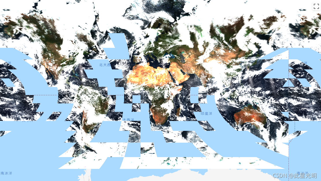
本文参与 腾讯云自媒体同步曝光计划,分享自作者个人站点/博客。
原始发表:2024-05-24,如有侵权请联系 cloudcommunity@tencent.com 删除
评论
登录后参与评论
推荐阅读
腾讯云开发者

Copyright © 2013 - 2026 Tencent Cloud. All Rights Reserved. 腾讯云 版权所有
深圳市腾讯计算机系统有限公司 ICP备案/许可证号:粤B2-20090059 ![]() 粤公网安备44030502008569号
粤公网安备44030502008569号
腾讯云计算(北京)有限责任公司 京ICP证150476号 | 京ICP备11018762号